


Example 2: Sediment in an estuary
Course subject(s)
1. Introducing Mathematical Modelling
Ems
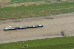
Photo: Martina Nolte: Creative Commons CC-by-sa-3.0 de
The Ems is a river in the North of Germany and the Netherlands. The last 100 km of the Ems form an estuary: the transition zone between a river and the sea. The tide transports salty seawater into the estuary, where it mixes with the fresh water from the river.
The Ems runs through a beautiful green landscape. If you visit the estuary however, you will see that the water is oddly brown and muddy. You might also miss an abundance of fish and water plants. Why is it so muddy? Can something be done to remedy this?
Background
The water carries a lot of sediment: suspended particles of a few micrometer, consisting of clay, silt, sand and organic matter. The sediment is eroded from the river bed and transported by the water, but also settles again on the river bed.
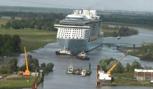
The Ems is used intensively for shipping. Additionally, in Papenburg, a city 90 km inland, a ship yard builds large cruise ships that have to be conveyed to the sea. To accommodate all those ships, the Ems has been deepened many times. This unnatural depth and narrowness of the river has had a number of effects. Compared to 1980, the river now flows much faster, and the sea tide influences the water level in the river much more, resulting in a larger risk of flooding.
The sediment concentrations in the estuary have increased at an alarming speed as well, resulting in brown water, layers of silt on the river banks, decreased fish and plant populations, and high costs to keep the deeper channel dredged.
Would moving the weir help?
A tidal weir is a low horizontal barrier across the width of a channel. It acts as a barrier for the salty sea water, but the fresh river water can flow over it. There is now a weir at 100 km inland. Would moving this weir to another position in the Ems help to reduce the sediment concentrations?
Measurements in the estuary
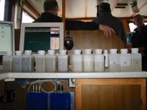
To predict the effects of a weir, you first have to measure the current water motion and the sediment concentrations. Ideally you want measurements at many spots in the estuary, at enough depths, and you also want to cover at least the whole tidal cycle of half a day. Either from a boat, or from a special buoy or pole, those measurements are very expensive, and never complete. Furthermore, you do not understand which mechanisms are essential and you can not investigate the impact of moving a weir.
Measurements in scale models
Real-life measurements can be complemented by measurements in a scale model: a large sand box, with a scaled freshwater inflow and a tidal wave (with a much shorter tidal cycle). A lot can be learned this way, but scaling such a long, shallow estuary is difficult, and scaling sediment particles is even more challenging.

Scale model at the Waterloopkundig Laboratorium in Delft ~1960.
Very recently a clever kind of scale model has been built in Utrecht: the Metronome: the sand box is tilted back and forth to simulate the tidal movement: The Metronome.
Mathematical modelling
Researchers have built mathematical models for the Ems as well. The models have to be carefully calibrated with measurements, but then they can be used to quickly simulate many scenarios: extreme weather or spring tides, but also simulations of what would happen with extra barriers or increased or decreased dredging.
With a so-called exploratory model, the effects were estimated of positioning a new tidal weir at different places in the estuary. The sediment concentrations were simulated with this model.
Simulations with an exploratory model
In the next video you see the results of these simulations of the sediment concentrations in the Ems. The horizontal axis shows the distance from approximately 50 km inland. The current weir lies near Herbrum, which is a city 100 km inland. Before you start the video, the position of the weir is at its current position. The results of the model reflect the current high concentrations of sediment in roughly the right place.
In the video you can see the effect of rebuilding the tidal barrier at a different place. It turns out that the position of the weir has a large effect on the quality of the water. Moving the barrier inland would help lower the sediment concentrations considerably. Unfortunately, moving the weir has, apart from the costs, more consequences, such as a higher risk of flooding and salty water that will penetrate deeper into fertile farmland. So this problem does not have an easy solution.
Article: Schuttelaars, H. M., de Jonge, V. N., Chernetsky, A., 2013. Improving the predictive power when modelling physical effects of human interventions in estuarine systems. Ocean & Coastal Management 79, 70–82.
Other mathematical models
The exploratory model above gives good qualitative results for the Ems estuary. And now you think, well, I know of another river with sediment problems. Could this model be used for this river as well? Unfortunately no, probably not. The simplifications used to derive this model are reasonable for (some phenomena in) the Ems, but not for all other estuaries. For example, the estuary of the Elbe (in Germany) is so much wider with so much more detail in the channels that you can not used a width-averaged model.
An exploratory model is a relatively small model, in which some variables have been simplified. For example the geometry of this model estuary is not three-dimensional, but two-dimensional: the width of the river has been averaged out. Because of these simplifications, the results can be calculated quickly, and many options and parameters can be explored in a few hours. To calculate results also quantitatively with a reasonable precision, they have to be calculated with a so-called simulation model that does not simplify as much and incorporates many more details. Those programs however can take a few days for one simulation (examples: Delft3D, ROMS and GETM).
Conclusion: the sedimentation of tidal rivers is a complicated problem, and still there are many open questions. Real measurements, measurements in scale models, exploratory models and simulation models all have their advantages and disadvantages and compliment each other. Before building a new expensive barrier, one needs to know how much it will improve the water quality. Accurate mathematical models are essential to make those predictions.
Now that you have seen some examples of mathematical models, maybe you’d like to share your thoughts on the usefulness of mathematical modelling. You can participate in the discussion in the next section.

Mathematical Modeling Basics by TU Delft OpenCourseWare is licensed under a Creative Commons Attribution-NonCommercial-ShareAlike 4.0 International License.
Based on a work at https://online-learning.tudelft.nl/courses/mathematical-modeling-basics/.