Geo-information Technology for Crisis Management – Reading 3
Course subject(s)
3. Use of Geo-information
Lecture 3: Use of Geo-information
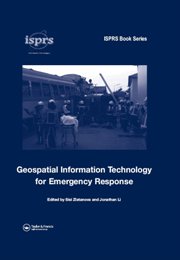
The readings for this lecture consist out of the chapters 3, 4, 5 and 17 from ‘Geospatial Information Technology for Emergency Response’ and some additional papers.
Chapter 3
This chapter is about collecting Real-time data and generating information using airborne sensors. The writers show that this data can be very useful for an emergency situation. For example, the data and information can be used to improve the response capability after an emergency situation has occurred. A table that summarises the relevant characteristics of the remote sensing data types can be used by decision makers to choose the best remote sensing tool for the different emergency situations.

Chapter 4
This chapter discusses the current satellite remote sensing technologies, international initiatives and future developments for fast data collection. Although satellite remote sensing is a great source of data for rapid emergency respond, it still faces challenges in real-time data collection due technical limitations. This paper will provide a guide for satellite data selection for a emergency situation.
Chapter 5
Although airborne and spaceborne remote sensing has proved their critical role in collection data covering a large geographic region, they fall short of capturing urban details due to the limitations of spatial resolution and viewing angle. This paper discusses the operational principles and future developments of terrestrial mobile mapping technology.
Chapter 17
This chapter will examine how GIS Technology is helping the fire service meet the needs of the community more efficiently than ever before. The GIS Technology provides the required information when, where and how it is needed.
Mike Kevany in Geospatial Information Technology for Emergency Repsonse
Mike kevany’s paper is about the lessons that are learned from all sorts of incidents and disasters that have occurred over the past few years. This chapter also presents an overview of recent geo-information developments that contribute to improvements in areas that are identified in these lessons.

Geo-information Technology for Crisis Management by TU Delft OpenCourseWare is licensed under a Creative Commons Attribution-NonCommercial-ShareAlike 4.0 International License.
Based on a work at https://ocw.tudelft.nl/courses/geo-information-technology-for-crisis-management/.


